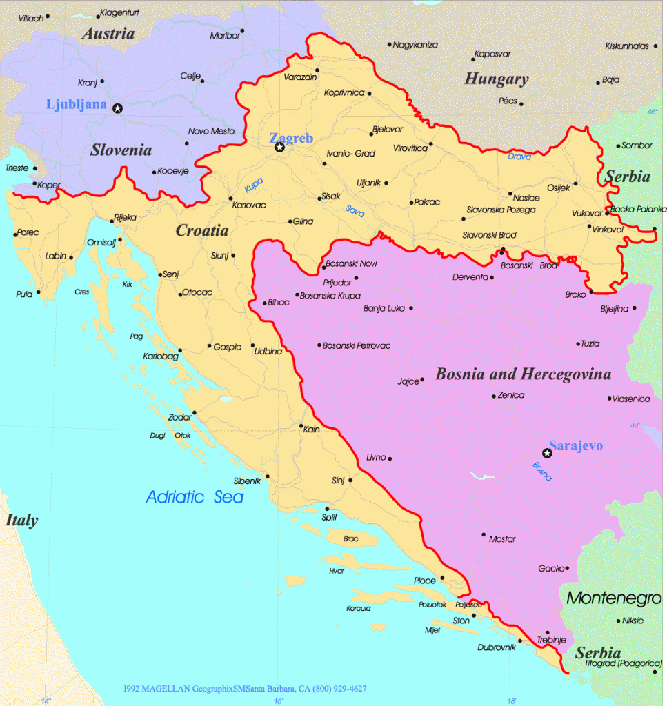
This map of Croatia shows the country’s location in southeastern Europe, as well as its major cities, islands, and rivers. Croatia is a small country with a long coastline, and it is bordered by Slovenia to the northwest, Hungary to the north, Serbia to the east, Bosnia and Herzegovina to the south, and Montenegro to the southwest.
If you are planning a trip to Croatia, this map can help you plan your itinerary and get an overview of the country’s geography. The map also includes information about major cities, islands, and rivers, so you can learn more about the places you want to visit.
Tags: Croatia map. Croatia city maps. Croatia borders. Croatia frontiers. Croatia cities. Croatia Geography. Physical Map of Croatia. Political Croatia Map.
Search
Balkan Countries
Pages
Follow Balkans Countries
Balkans Countries Travel
- Albania: Beaches, Mountains, History and Unique GastronomyBeaches of Albania: Discovering the Albanian Riviera Albania has emerged as one of the most attractive destinations in the Mediterranean thanks to its impressive coastline. The Albanian Riviera, which extends along the southern coast of the country, is famous for … Continue reading → The post Albania: Beaches, Mountains, History and Unique Gastronomy appeared first […]
- Discover Gjirokastra: The Stone City in AlbaniaThe History and Charm of Gjirokastra Gjirokastra, known as the “Stone City”, is a historical jewel in southern Albania. Its rich history and well-preserved Ottoman architecture have made it a UNESCO World Heritage Site. The city is famous for its … Continue reading → The post Discover Gjirokastra: The Stone City in Albania appeared first […]
- Albania: Beaches, Mountains, History and Unique Gastronomy